GEOSCOPE
Country
United States
Language
English
Source form
Speculative design-science project, architectural proposal, simulation environment, and planetary visualization system.
Representation links
Buckminster Fuller Institute, Geoscope:
https://www.bfi.org/about-fuller/big-ideas/geoscope/
World Game Series: Document One, Buckminster Fuller Institute PDF:
https://www.bfi.org/wp-content/uploads/2014/02/world_game_series_document1.pdf
Source-world
The Geoscope belongs to R. Buckminster Fuller’s American design-science universe: a body of projects, writings, lectures, prototypes, and systems proposals concerned with global resources, planetary coordination, environmental knowledge, and the World Game. It is a proposed technical environment rather than a literary fiction or filmic prop: a planetary data apparatus meant to make Earth-scale patterns visible and usable for collective decision-making. The Buckminster Fuller Institute describes it as an immersive and interactive Earth connected to world data and oriented toward synoptic visualization, simulation, and planetary stewardship.
Construction
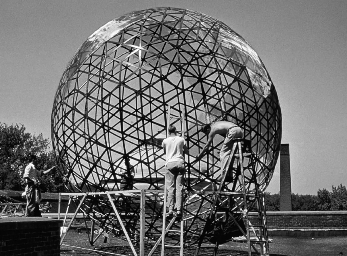
The Geoscope is a large spherical or geodesic planetary display system. It consists of a globe-like structure, translucent or glass surfaces, cartographic geometry, data layers, light-based display elements, computer-linked information sources, and a spatial environment that can be entered, viewed, or collectively used. Fuller imagined it as a spherical Earth display, a kind of celestial theatre, and an instrument for visualizing planetary data.
The Geoscope exists in several scales and versions: small one-person geoscopes, twenty-foot collaborative globes, a proposed two-hundred-foot sphere, and a later four-hundred-foot version with satellite data scaled down to the level of the user’s home. Fuller also imagined a computerized spherical display whose surface elements could respond to data signals.
Operation
The Geoscope displays planetary information as spatial and temporal patterns. Data about population, resources, production, distribution, weather, climate, navigation, energy, and global change are mapped onto the globe as visible layers. Users can inspect the Earth from inside the sphere, compare global patterns, run simulations, change the temporal scale, and test strategies for planetary problem-solving.
In connection with the World Game, the Geoscope becomes a collaborative decision environment. Players use the planetary display to model resource use, test scenarios, and compare the consequences of different strategies. The machine turns the planet into an interface: the Earth is no longer only represented as a map, but processed as a dynamic database for collective planning.
Modes
Globe, map, numerical data, light display, simulation, diagram, spatial immersion, temporal animation, collaborative gameplay.
Interface / user position
The user is a planetary observer, planner, or player. The Geoscope positions users either inside or around a model of Earth, transforming them into interpreters of global systems and participants in scenario-based world management.
Epistemic promise
Planetary literacy; synoptic visualization; prediction; whole-systems thinking; global scenario testing; making large-scale patterns visible and actionable.
Political / social stakes
The Geoscope offers a democratic image of shared planetary intelligence, but it also carries technocratic implications. It imagines global problems as problems of data visualization, modeling, and rational coordination. Its political tension lies between collective empowerment and the dream of planetary management through comprehensive information display.
References
Buckminster Fuller Institute. “Geoscope.” Accessed July 6, 2026
Columbia GSAPP. “Buckminster Fuller’s World Game.” Accessed July 6, 2026
Fuller, R. Buckminster. Critical Path. New York: St. Martin’s Press, 1981
Fuller, R. Buckminster. Operating Manual for Spaceship Earth. Carbondale: Southern Illinois University Press, 1969.
Krausse, Joachim, and Claude Lichtenstein, eds. Your Private Sky: R. Buckminster Fuller; The Art of Design Science. Baden: Lars Müller Publishers, 1999.